The monastic phase at Brockley is so short (less than 30 years) that the likelihood of substantial archaeological survival of monastic structures is minimal. However, some buildings must have been in existence by the end of the monastic phase and any buildings completed and in use by 1208 will doubtless have been re-used, adapted and rebuilt through successive grange farm or secular farm activities.
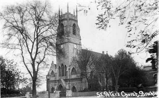
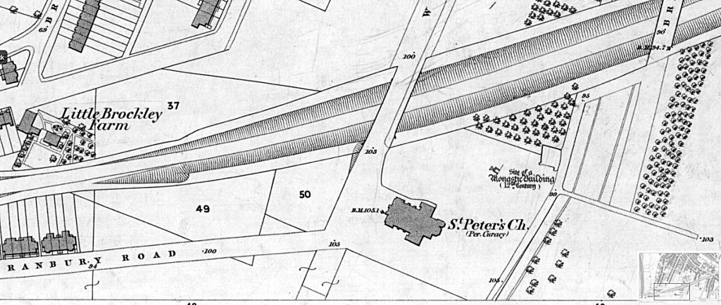
The Brockley area remained largely rural until the late 18th C when it began to become absorbed by London’s expansion. At first it developed into areas of market gardening and brickworks and then slowly became engulfed by housing. When the first edition 25″ O.S. map is surveyed (1869-71) the area is still mixed housing and farmland, and ‘Little Brockley Farm’ and ‘Manor Farm’ are shown amid orchards and open fields around the newly built St Peter’s church on Wickham Road. The arrival of the London Chatham and Dover Railway branch in the 1860s ensured Brockley’s future as a suburb and although the railway line cut right through the presumed site of Brockley Abbey, there are no reports of finds from that time.
That said, the site of Brockley Abbey abbey had clearly remained in folk memory for, Nathan Dews, writing in 1884, comments: ‘For many years some grassy mounds, on which the ruin-loving nettle luxuriated, marked the spot, in a meadow belonging to Mr Myatt, of Manor Farm, Deptford, where the monastery was supposed to be situated. Rubbish being required to form a roadway on the farm, one of the mounds was dug away, when the foundations of the refectory were brought to light. It was noticeable that each of the corners of the building pointed to one of the cardinal points. The length of the room was 34 ft. 6 in., whilst the width was 21 ft. 6 in. At the N.W. end was a recess 10 ft by 9 ft. 6 in. from out to out – the whole of the walls were 2 ft. in thickness. On the south-west side was an entrance of 3 ft. 6 in. wide. The floor had been originally laid with large red tiles about 11/2 in. thick, having bevelled edges by which they were enabled to be laid close together. A few white glazed tiles resembling the Dutch tiles were also found, together with fragments of glass with lead work still adhering to it from some of the windows, several coins of Charles I., and a number of coins, amongst which were two silver pennies of Edward IV., a shilling of Edward VI., one of Elizabeth and one of Charles I., and Louis XIV., and a Deptford token . . . There were also found an antique key, an ancient buckle, and other trifles.‘
It has been said (on HER reports and elsewhere) that this structure cannot be medieval on account of the coin finds, but I think it is quite possible it was a monastic (or grange) building reused through the thirteenth to the seventeenth centuries – although it’s a bit of a long shot to label it a ‘refectory’ without more structural evidence. This whole area is now under houses and streets but there may be still something to find when redevelopment takes place. The site has recently been defined as an Archaeological Priority Area (APA).
Between 1866 and 1870, St Peter’s church was built, designed by architect Frederick Marrable. During the digging of the foundations, a well was discovered which is thought may belong to the Premonstratensian Abbey.