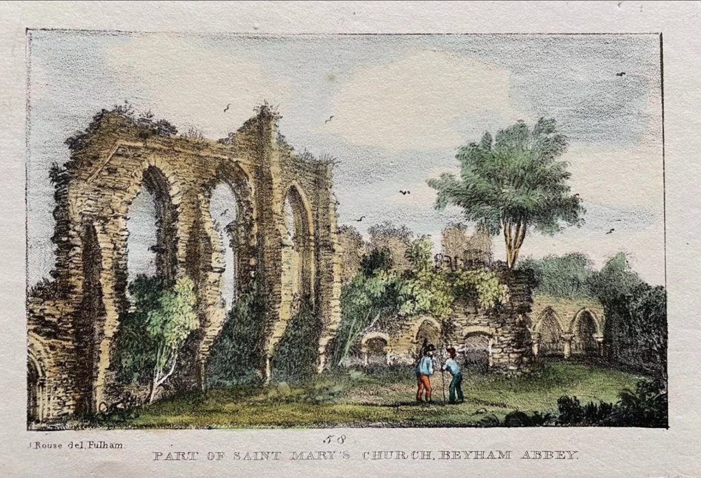
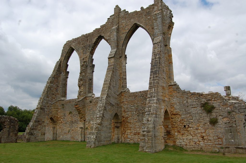
The earliest consolidation works at Bayham are the massive buttresses built against the south wall of the nave of the abbey church. This work is believed to have been carried out by William Wilkins and Humphrey Repton as part of the landscaping scheme to create a ‘ruin garden’ for the Earl’s house in the early 1800s. Some of the earliest engravings of the site (e.g. that by James Rouse (snr) see below) show the nave wall before the modern buttresses and it is clear that there were pre-existing buttresses which were probably flying buttresses in order to facilitate the use of the north cloister walk. It seems likely that the original arches in the buttresses were much wider than those in the reconstituted versions.
A detailed description of the layout and architecture of Bayham was published in the publication known as ‘The Builder‘, on 3 July 1897 together with a detailed plan. (pp. 9 – 12 + plan). A very similar plan was published by W. H. St John Hope in the Archaeological Journal (Vol 62, 1905, plan facing p. 179).
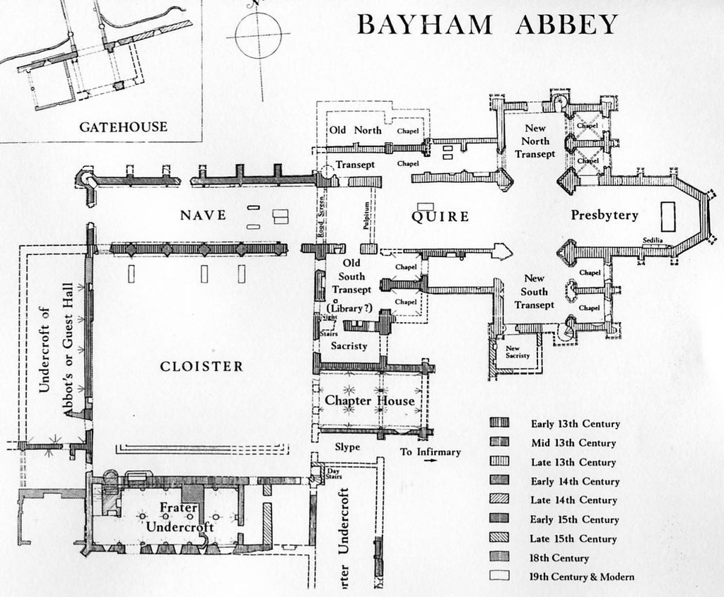
When the site was placed in guardianship in 1961, the Ministry of Public Buildings and Works undertook to stabilise the ruins and make them safe for public viewing. As part of this work excavation and consolidation took place and a new plan of the site was created detailing the broad phasing of alterations carried out during the life of the abbey. The plan was published in the Bayham Abbey guidebook published by the Department of the Environment in 1974.
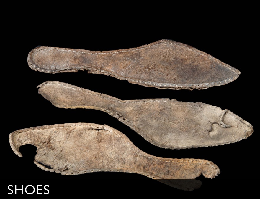
Between 1973 and 1976 excavations of the south range of the cloister were carried out by Helen Sutermeister. Following her death, this work was written up and published by Anthony Streeten in 1983 (Bayham Abbey: Recent Research, including a report on excavations (1973-76)). Among the notable finds from the excavations was a device resembling a large set of tweezers, said to be a page turning implement and several examples of medieval shoes, the leather preserved due to the waterlogged conditions. More artefacts discovered at Bayham can be found on the Historic England website HERE.
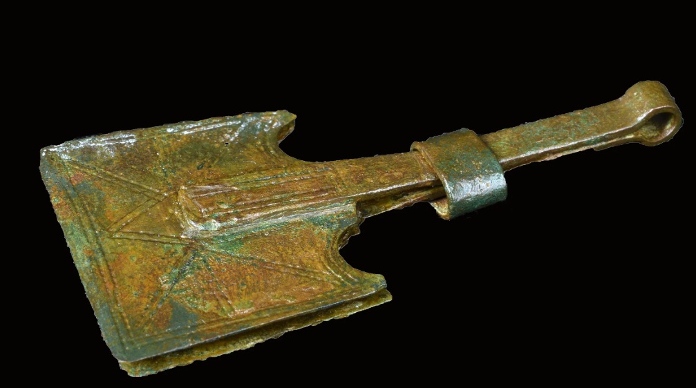
Some of the finds from excavation of the southern range of Bayham Abbey in the 1970s. To the left a device thought to be a page turner for parchment books and below, parts of medieval leather shoes. (© Historic England)
Streeten’s report on the archaeological work gives the most up-to-date plan currently published for Bayham, with details of his findings in the west range included. This is the plan published in the current guidebook (Rigold & Coad, 2005) last reprinted in 2016 but currently out of print, awaiting revision. A copy of the plan is reproduced below:
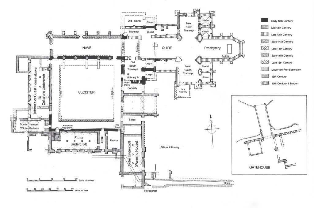
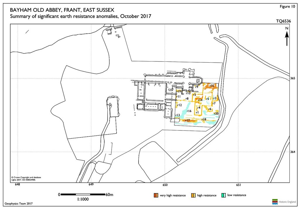
Researchers were aware that some monastic buildings, notably the infirmary range, were missing from the surviving ruins. In October 2017, Historic England carried out a series of geophysical surveys in order to explore areas of the site. In particular, they were keen to locate the original east wall of the presbytery and also to find the lost infirmary buildings. Positive results were obtained in both these objectives and several other features of interest were picked up by the survey. Full details can be found in the survey report which can be found HERE and there is a useful summary on the Historic England site HERE